County
Laois
Distance
6.3 km
Duration
2 hours
Difficulty
Challenging
Total Ascent
250 m
Activity
Hiking
At the trailhead
- Parking · Cullahill Village Car Park
- Public transport · Bus
- No dogs
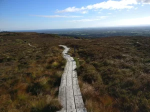
This loop follows field paths, woodland tracks, lanes and minor roadways in a cluster of low hills above the village of Cullahill with fine views of rural County Laois as well as some of the mountains in the surrounding counties, while closer to hand it passes the ruins of Cullahill Castle, a Lime Kiln, Cummer Well and a Rath or Fort.
Download GPX
Route data: Get Ireland Active – Sport Ireland
Elevation profile
Elevation data: EU-DEM 25 m © European Union, Copernicus. Profile follows the main waymarked line.
Along the way
Heritage & points of interest
Food & drink
Nature & wildlife
Data sources: map & points of interest © OpenStreetMap contributors · facilities from Get Ireland Active – Sport Ireland · species via GBIF · protected areas via NPWS.