County
Kerry
Distance
4.6 km
Duration
1.3 hours
Difficulty
Moderate
Total Ascent
131 m
Activity
Hiking
At the trailhead
- Parking · Cloghane Village
- Public transport
- No dogs
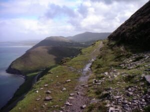
This looped walk takes in sites of archaeological interest as well as beautiful views of the Brandon Mountain Range, Brandon Bay and the surrounding area. It is named after The Cluain Searrach Stone Alignment which is on the route. The ruins in the old churchyard on Bóthar an Teampaill at the start of the trail consist of the original 13th century Teampall Bréanainn and a Church of Ireland addition dating from 1828. The mass dial on the southern wall of the original church is one of only thirty known in Ireland. There is also a replica of the head of the mythological figure, Crom Dubh. The original, which was embedded in the wall of Teampall Bréanainn, was stolen in 1993.
The site of St Brendan’s Well was once the location of rituals accompanying the Cloghane Pattern, a great gathering held on Domhnach Crom Dubh, the last Sunday in July, during the ancient Mount Brandon Lughnasa Festival. On much of the walk there are spectacular views of Cloghane Estuary and Brandon Bay with the archaeologically rich valley of Loch an Dúin in the distance.
Elevation profile
Elevation data: EU-DEM 25 m © European Union, Copernicus. Profile follows the main waymarked line.
Along the way
Heritage & points of interest
Food & drink
Nature & wildlife
Data sources: map & points of interest © OpenStreetMap contributors · facilities from Get Ireland Active – Sport Ireland · species via GBIF · protected areas via NPWS.